
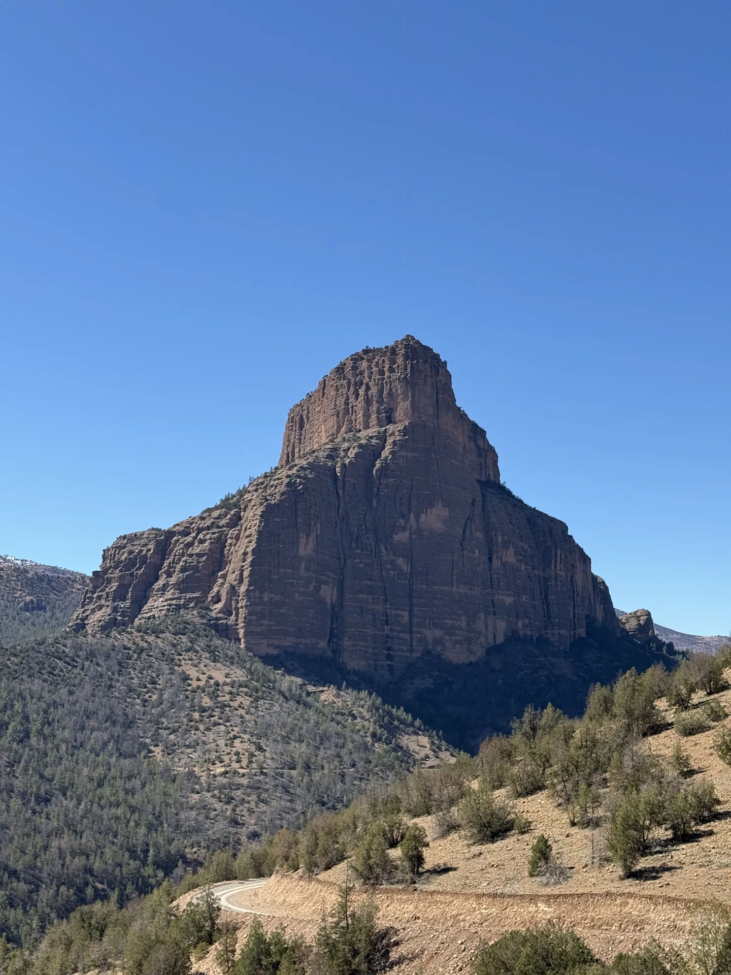
Jebel Imsfrane, locally known as Msfrane and nicknamed the Cathedral for its rocky outline, rises above the Tilouguite area. This guide covers the summit hike, its approximate elevation gain, walking conditions and the value of a local guide.
What is Jebel Imsfrane?
The mountain rises to approximately 1,868 metres in the Tilouguite commune of Azilal province. Its dramatic rocky shape inspired the descriptive nickname “Cathedral”; the name refers to the profile of the cliffs, not to a religious site. Forest, rugged rock and valleys meet in a compact mountain landscape.
Msfrane is also a place with Amazigh language and local histories. Ask residents and local guides about the names of paths and surrounding places rather than relying on invented stories presented as facts.
Route, time and height gained
A guided summit programme may take roughly four to five hours, depending on its starting point, the group and conditions. The cited ascent involves about 668 metres of elevation gain. It is generally considered a moderate walk for reasonably active hikers, with some steeper or more exposed sections.
Do not confuse a programme duration with a guaranteed walking time for everyone. Breaks, wet stones, changing visibility and fitness levels all matter. Clarify whether the stated time includes both the ascent and descent, as well as transport from your accommodation.
Landscape along the trail
A walk towards the summit may pass woodland, stony tracks and open viewpoints across the valley. The mountain looks like a single great rock from a distance, yet the route reveals smaller ridges, changing slopes and striking perspectives.
Take time for the views without making the summit photo the only goal. The best stopping points are the ones the group can reach and leave safely within the available daylight.
When to set off
Morning air can be cool even when the midday sun feels strong. Wind, rain and cloud can transform exposed rock quickly, and wet sections require more care. A general city forecast cannot replace conditions around the summit itself.
A reasonably early departure creates time for rests, photographs and a safe return. If weather deteriorates or someone becomes exhausted, changing the plan or turning back is a sensible decision.
What to bring
Wear grippy hiking shoes that you already know are comfortable. Carry enough water, a snack or meal, a warm layer, sun protection and a wind- or rain-resistant jacket. A charged phone, a small personal first-aid kit and a light are prudent extras.
Keep the bag manageable. Hiking poles may help on descents, but they cannot substitute for care on steep terrain. Tell your guide beforehand if you struggle with heights or uneven ground.
Why a local guide matters
A guide helps choose the route, set the pace, manage more difficult passages and share information about the landscape and surrounding villages. This is valuable when the path is unfamiliar or the weather unpredictable.
A locally described summit guiding programme costs around 300 MAD per group, subject to confirmation. Ask what is included, the group size and whether collection from your lodging can be arranged.
Leave the mountain as you found it
Use appropriate trails, take all waste away, respect private land and ask permission before photographing people. The surrounding area is home to communities, animals and fragile vegetation, not simply a scenic backdrop.
A successful hike means returning safely with a deeper understanding of Imsfrane, not ticking off the summit at any cost.